IMD extends rain alert for Delhi-NCR till September 6
Showers are not done with the capital yet. The India Meteorological Department has kept the region on alert through September 6, flagging more rounds of rain and thunderstorms across Delhi-NCR. Noida and Ghaziabad are on red alert, while Gurugram and Faridabad remain on orange. In the hills, parts of Himachal Pradesh and Uttarakhand are under red alert for very heavy rain and flash floods. The broader picture: multiple North Indian states face shifting orange and red alerts as the system moves.
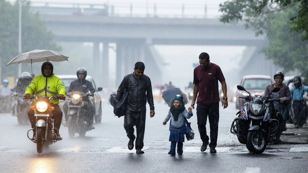
On Monday, September 2, Delhi saw a textbook monsoon day: mostly cloudy skies, several spells of light to moderate rain, and a few heavy bursts in the afternoon and evening. Daytime temperatures hovered around 29–30°C, and nights dipped to 21–23°C—about 3–5°C below normal for early September. Surface winds blew in from the east and southeast at up to 20 kmph, with gusts around 36 kmph. Morning humidity stayed near 90%, which explains the sticky feel even when the mercury was down.
The heaviest pocket hit Gurugram, where the district recorded more than 100 mm of rain between 3 pm and 7 pm on Monday. The district administration advised private offices to switch to work-from-home for the day and asked schools to conduct classes online, citing waterlogging and slow traffic. Officials said the aim was simple: reduce road load, keep people safe, and give civic teams room to clear drains.
Across the National Capital Region, alerts are being tailored location by location. Noida and Ghaziabad sit under red alert due to the risk of very heavy showers and thunderstorms. Gurugram and Faridabad are on orange alert, which still means heavy rain is possible in pockets, with thunder and lightning likely. IMD guidance points to a wet Tuesday too, with intermittent showers and a chance of brief intense spells.
Flood watch is back on the checklist in Delhi. The government has warned that the Yamuna level at the Old Railway Bridge could cross the danger mark of 206.50 meters if upstream inflows rise. Relief camps have been opened in places like Mayur Vihar, and teams are on standby near embankments and low-lying colonies. Residents in flood-prone stretches have been asked to keep essentials handy and be prepared for quick evacuation if needed.
Travel was already feeling the strain. IndiGo cautioned passengers about delays because traffic to the airports slowed down in the rain. Air India also asked flyers to check flight status before heading out. If you have a flight this week, add buffer time for the drive, plan for security queues, and carry a rain cover for luggage. Expect snarl-ups at usual chokepoints and around underpasses that tend to flood during heavy showers.
Urban services are working overtime. Pumping stations are clearing water at known hotspots, and road crews are scraping silt from drains to prevent repeat flooding during the next burst. Short, intense downpours can trip power feeders, so officials are urging caution around waterlogged areas and any exposed cables. If you spot sparking, call the local helpline and keep a safe distance.
Why is it raining this hard again? A monsoon low over central India is feeding moisture into the northern plains, while the monsoon trough is aligned close to Delhi-NCR. That setup pulls in damp air from both the Bay of Bengal and the Arabian Sea. When daytime heating peaks and the moist winds converge, you get fast-building storm clouds and those 20–40 minute cloudbursts that flood city streets.
Himachal Pradesh and Uttarakhand sit in a risk zone this week. The red alert there covers very heavy to extremely heavy rain in parts, with a real chance of flash floods, landslides, and sudden rises in mountain streams. Travel in the hills can turn risky very quickly when slopes get saturated. Tourists and pilgrims are better off checking local advisories, staying off narrow hill roads during active rainfall, and avoiding riverbanks.
Further south and east, parts of Madhya Pradesh and Uttar Pradesh are also on red alert for intense thunderstorms and heavy rain that can exceed 15 mm per hour. That kind of rate can overwhelm drains and trigger waterlogging in towns even if the total daily rainfall is not record-breaking. If you live near a seasonal drain or a low-lying plot, keep a watch when the rain picks up.
Here’s how the week is shaping up for Delhi-NCR weather based on the current setup:
- September 3 (Tuesday): Intermittent light to moderate rain across the city and suburbs, with one or two heavy spells likely in the afternoon or evening. Thunder and lightning possible.
- September 4–5 (Wednesday–Thursday): More rounds of showers. Cloudy and breezy in phases. Daytime temperatures likely to stay on the pleasant side for September.
- September 6 (Friday): Chances of rain remain, but intensity may ease in many parts. Localized heavy showers cannot be ruled out.
Specific inputs from the field match the forecast. Road engineers say underpasses and low-lying pockets are their first priority after every burst. Storm drains need repeated clearing to prevent backflow. Garbage and silt blocking grates can undo hours of pumping in minutes, which is why residents are asked not to dump waste near drains during wet weeks like this.
For daily commuters, a few practical steps go a long way. Check the route before you start, keep headlights on low beam in heavy rain, and avoid driving through water if you can’t see the road markings. If you ride a two-wheeler, slow down well before turns, use both brakes gently, and give larger vehicles extra space. In cars, keep the AC on fresh mode if windows fog up and use hazard lights only when stopped.
Delhi Metro usually runs on schedule during rain, but speed restrictions can kick in during very intense storms. Build in a little extra time for interchanges and last-mile rides. DTC and cluster buses tend to crawl when water pools at junctions—carry a small umbrella and wear footwear that can handle puddles.
Schools and offices are adjusting. Some NCR schools have moved classes online on rain-heavy days to avoid long bus rides through waterlogged stretches. Offices in flood-prone business parks are reviewing staggered timings and hybrid work to ease peak-hour pressure. For parents, the safe bet is to check the morning advisory before heading out.
Health-wise, this is classic “humid monsoon” weather. Drink clean, boiled, or filtered water. Skip cut fruit and street-side salads for a few days if you are prone to stomach bugs. Clear stagnant water around homes to check mosquito breeding. If you have a respiratory condition, keep medications handy—damp air can trigger symptoms for some people.
What this means for residents, travel, and city services
Low-lying residential pockets need special care this week. If your neighborhood floods often, park vehicles on higher ground ahead of a heavy-rain window, unplug non-essential appliances if water starts creeping in, and keep important documents in zip bags. Ensure the elderly and kids don’t wade through water, and help neighbors with disabilities if evacuations are called.
For those living near the Yamuna floodplains, follow local instructions closely. Keep a go-bag ready with IDs, basic medicines, a torch, a power bank, dry snacks, and a change of clothes. Relief camps in east Delhi have been activated as a precaution, and civic teams are mapping vulnerable points along the embankments.
In Noida and Ghaziabad, where the alert level is higher, resident welfare associations are arranging sandbags at entry slopes to basement parking and testing sump pumps. Housing societies should check diesel for backup generators and confirm drain outlets are not blocked by construction debris.
Gurugram and Faridabad, both on orange alert, face a familiar pattern—quick waterlogging on the main carriageway followed by slow recession once pumps get going. It helps when offices stagger end-of-day timings to avoid everyone getting on the road during a late-evening burst. If you can, shift non-essential travel to mid-morning windows between rain bands.
Here’s a short safety checklist for the wet spell:
- Avoid underpasses and stretches known to flood; take the longer but safer route.
- Do not touch electric poles, cables, or junction boxes in waterlogged areas.
- Keep phones charged; store emergency contacts and local helpline numbers.
- If driving, maintain twice the usual braking distance and keep speeds moderate.
- At home, elevate multi-plug extensions and keep a basic first-aid kit accessible.
Farm communities on the NCR fringes and in western Uttar Pradesh should drain standing water from fields where possible, delay fertilizer application until the soil firms up, and check paddy nurseries for water stress after heavy spells. Livestock sheds need dry bedding and proper runoff channels to prevent hoof infections.
Civic agencies—MCD, PWD, DJB, and the flood control department—are rotating teams for night checks at pump houses and at culverts feeding into the Yamuna. Traffic police are deploying diversions near waterlogged corridors and urging motorists not to remove barricades placed to block unsafe stretches.
For official updates, rely on state disaster management advisories, weather bulletins, and verified handles from district administrations. Radio alerts and SMS advisories often arrive before the rain hits your area, which can be the difference between a smooth detour and getting stuck.
The bottom line for the week: keep plans flexible, watch the sky in the afternoon and evening, and expect a stop-start commute pattern. The rain will help bring the heat down, but the mix of wind, lightning, and short heavy bursts means a bit of patience—and a good rain jacket—will serve you well.