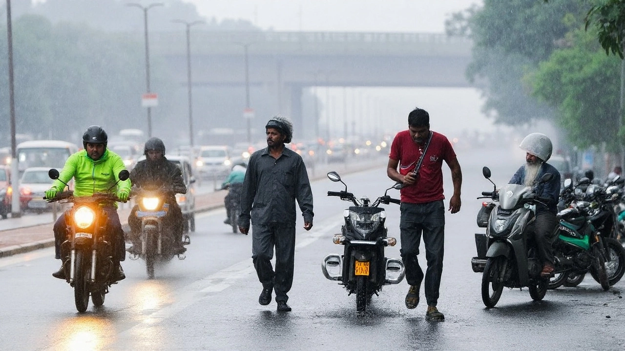
Heavy rain grips Delhi-NCR as IMD flags prolonged wet spell; Yamuna breaches danger mark
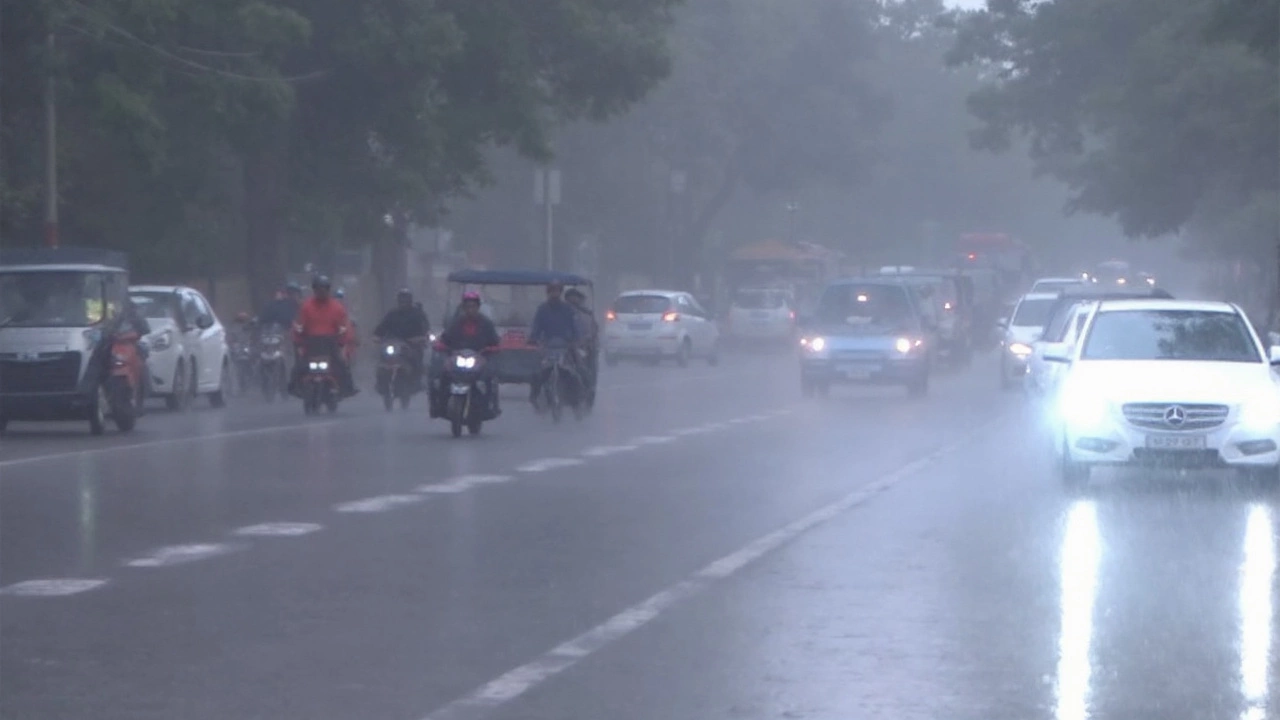
Rain is not letting up in Delhi-NCR. The India Meteorological Department (IMD) says the wet spell will hold through September 6, with cloudy skies, light to moderate showers, and pockets of heavy rain. Thunderstorms are likely on most days. Daytime temperatures will stay a notch below normal, hovering around 29–31°C on September 4, with the broader range between 24°C and 33°C. Winds from the southeast could gust up to 25 kmph, adding to the stormy feel.
IMD’s city-level advisories spell out what to expect: Noida and Ghaziabad remain on a yellow alert for light rain and thunderstorms, while Gurugram sits under an orange alert, which means moderate rain with a higher chance of disruption. The national capital can expect on-and-off thunder activity through the day, short sharp downpours, and waterlogging in usual hotspots.
The big worry sits on the banks of the Yamuna. The river has crossed the danger mark at the Old Railway Bridge, with levels touching 206.03 metres before rising further to 207.44 metres by Wednesday night—well past the evacuation threshold and just below the 1978 flood peak of 207.49 metres. Authorities have shut the bridge to traffic. At Nigambodh Ghat, floodwaters entered the complex, forcing a temporary halt to cremations and pushing families to alternative facilities.
Schools are tilting toward caution. While Delhi has not announced a blanket closure at the time of writing, several NCR pockets—Ghaziabad and Noida among them—have moved to shut schools for the day, with Delhi schools preparing online classes if the rain intensifies. Parents are being told to wait for official school messages rather than rely on social media forwards.
The region is logging serious rain totals this monsoon. Delhi has crossed 1,000 mm so far—well past its annual average of around 774 mm. The IMD says this broad wet phase over northwest India may stretch to September 9, with intensity shifting day by day as systems move.
Across the wider north, the alerts are starker. Himachal Pradesh and Uttarakhand are on high alert for very heavy to extremely heavy rain. Landslides, flash floods in mountain streams, and road blockages are real risks. Punjab has already shut all government, aided, and private schools, colleges, universities, and polytechnics until September 7 as flood conditions worsen. An orange alert covers Jammu & Kashmir, Punjab, Haryana, west Rajasthan, Madhya Pradesh, Telangana, and parts of Maharashtra, stretching down to Goa and the coastal belt of Andhra Pradesh. For travelers and commuters, that translates into a week of disruptions.
Aviation is under pressure. SpiceJet has warned passengers of cascading delays due to weather in Delhi, asking flyers to keep checking their flight status. Other carriers typically follow the same playbook when storms cluster over the capital: long queues at security and boarding, last-minute gate changes, and rolling delays as aircraft and crews rotate late into the night.
So why is this happening now? In early September, the monsoon trough often shifts north, aligning near Delhi and the foothills. When that happens alongside a moisture-laden flow from the Bay of Bengal and the Arabian Sea, the stage is set for sustained rain. Add a passing western disturbance in the upper air, and thunderstorms get a boost. IMD’s model guidance points to repeated pulses feeding the system—enough to keep showers going even between heavy bursts.
On the flood front, the Yamuna’s behavior depends on rain upstream and controlled releases at barrages. When hill states take a pounding, water levels rise quickly downstream. Low-lying floodplains in Delhi get hit first, and river islands and ghats face inundation. Once the river climbs past the warning level, evacuation plans kick in: people and cattle are moved, temporary shelters open, and essential supplies are routed through relief teams. With levels flirting with historic highs this week, all of that remains in play.
City services are stretched but active. Drainage pumps run longer, traffic police put out diversions, and power utilities step in where transformer yards face seepage. In areas near the river, civic workers build up sandbag walls and clear out drains of silt and trash to speed runoff. Residents in basement apartments and ground-floor shops have been told to move valuables higher and secure power connections.
Within Delhi-NCR, the alert gradient matters. A yellow alert is a heads-up: conditions are favorable for rain and thunderstorms, with a low to moderate chance of impact. Orange means “be prepared”—moderate to heavy rain in spells, and a higher likelihood of traffic snarls, waterlogging, and short-term power interruptions. The IMD reserves the red alert for the rare days when very heavy to extremely heavy rain is expected and the risk of serious disruption is high. For now, the capital sits in the middle band, but fast-evolving storm cells can push local scenes to near-red impacts for short windows.
Commuting stays tricky. Early morning rain tends to flood underpasses and bottlenecks before pumps clear them, and evening storms often catch office-goers on the road. Ride-hailing wait times spike. If you must step out, plan buffers of at least 30–45 minutes, and favor metro and rail when possible. Roads near the river, underpasses around ITO and ring road stretches, and known waterlogging zones in east and south Delhi need extra caution.
North India beyond Delhi faces a mixed map. Uttarakhand’s Garhwal and Kumaon belts can see very intense showers, especially along steep slopes and valleys. Himachal’s Kullu, Mandi, and Kangra districts are prone to landslides after sustained rain, which can cut off roads without warning. In plains states—Punjab, Haryana, and west Rajasthan—heavy rain in short bursts tends to flood fields and village roads, with slower drainage in low-lying farms. In central India, parts of Madhya Pradesh are in line for moderate to heavy rain as the moisture plume shifts west-northwest. Down south in Telangana and along the Konkan–Goa–coastal Andhra stretch, sea breeze interactions can fire late-afternoon thunderstorms, leading to quick but intense showers.
One more factor to watch is wind shear during storm hours. When gust fronts surge ahead of thunderstorms, visibility can drop fast, tree branches can snap, and scaffolding or hoardings become hazards. That’s why authorities push for staying indoors during lightning, avoiding flyovers and open grounds when thunder is overhead, and not sheltering under lone trees.
Public health teams are also on alert. Standing water after heavy rain is a magnet for mosquitoes, and with the monsoon carrying into September, dengue prevention is top of mind. Flooded drains bring a higher risk of water-borne infections if sanitation slips. Relief camps and temporary shelters are being stocked with drinking water, bleaching powder, and basic medicines to cut that risk.
What should residents do now? IMD’s advice is basic but effective: keep tabs on official forecasts, avoid unnecessary travel during peak rain, and stay away from swollen drains and riverbanks. If you live near the Yamuna floodplain, keep essentials packed and documents sealed in waterproof bags. Park cars on higher ground. If you work late shifts, carry a flashlight and a power bank—long power cuts aren’t common, but they do happen when feeders trip in thunderstorms.
For parents, the school question hangs over every rainy week. District authorities issue daily orders based on fresh IMD updates. If schools switch to online classes, expect short, focused sessions rather than full-day schedules. For in-person days, expect delayed starts to dodge the harshest morning showers, and plan for staggered dispersal to manage traffic around school gates. Buses may run slower than usual; a spare umbrella in the bag helps.
For businesses, the safest bet is flexible work hours and remote options when alerts go orange. Construction sites need extra safety checks: harnesses, secure scaffolding, and tarps tied down. Warehouses in low-lying zones should keep pallets lifted to avoid water damage. Delivery firms already pad schedules, but customers should prep for slippage as riders navigate flooded stretches.
Transport authorities are in constant triage mode. On heavy-rain days, airlines push rolling advisories, and air traffic control screens for storm cells near the runway. Check-in queues swell as passengers rebook, so arriving early helps. On the ground, bus depots move extra vehicles to dry parking and reroute services away from waterlogged corridors when needed.
From a climate lens, swings like this—dry spells interrupted by intense bursts—are becoming more common. Warmer air holds more moisture, which can fuel heavier rain when conditions line up. City planners have long argued for bigger drains, more pumping capacity, and wider green buffers along rivers. Each wet year makes those upgrades harder to delay.
The next 72 to 96 hours will be the key window. If upstream rainfall eases, the Yamuna can stabilize and start to fall, lifting the pressure on low-lying neighborhoods. If hill-state rain stays strong, levels can climb again, even if Delhi’s own showers are moderate. That see-saw is why the river warning stays in force until the surge passes.
Here’s a quick checklist many families in flood-prone areas find useful:
- Charge phones and power banks; store drinking water and dry food for 24–48 hours.
- Keep IDs, house papers, and medical prescriptions in sealed plastic folders.
- Unplug appliances if water enters rooms; don’t touch wet switches.
- Avoid basement parking and underpasses during heavy rain.
- Don’t drive through fast-moving water; turn back if you can’t judge depth.
- Watch for official evacuation advisories; move early rather than late.
- Use boots or sturdy sandals in flooded areas to avoid cuts and infections.
- For children and seniors, plan medicine refills before the weekend.
As the week unfolds, expect more district-level orders based on real-time rain and river readings. Punjab’s blanket closure until September 7 is a sign of how seriously states are taking this spell. In Delhi-NCR, the fine print will change day by day—yellow to orange and back again—as storms pulse across the map. Keep an eye on IMD bulletins and updates from city agencies. The safest approach right now: treat the Delhi rain alert as active, stay flexible, and cut non-essential travel until the monsoon loosens its grip.
What the alerts mean for your city and how to plan your week
Delhi: Expect cloudy skies, multiple thunder bursts, and light to moderate rain most days until September 6. Daytime highs near 29–31°C on September 4, with a wider band of 24–33°C through the week. Watch the Yamuna level updates closely if you live near the floodplain.
Noida and Ghaziabad: Yellow alert stays in force. Intermittent showers and thunderstorms are likely. Some schools are closed; check for day-to-day orders. Waterlogging in usual pockets can slow commutes.
Gurugram: On orange alert. Moderate rain in spells, with a higher chance of disruption. Office hubs and underpasses can clog fast when storms hit at peak traffic. Work-from-home flexibility helps on the wettest days.
Himachal Pradesh and Uttarakhand: High alert for very heavy to extremely heavy rain. Landslides and flash floods are the main risks. Avoid non-essential hill travel, especially at night, and check road status before setting out.
Punjab, Haryana, J&K, west Rajasthan, Madhya Pradesh, Telangana, Goa, and coastal Andhra Pradesh: Orange alert zones in parts. Expect scattered heavy showers, localized flooding, and travel delays. Punjab’s education shutdown through September 7 is in effect statewide.
Aviation and intercity travel: Weather-related delays are likely at Delhi. SpiceJet has warned of disruptions; others usually follow similar advisories during such spells. Build in buffers and keep your bookings flexible. Rail and road corridors in hill states can see sudden blocks due to slides.
The monsoon is in a volatile mood, but the signals are clear and the preparations are visible. If forecasts hold, the rain will ease after September 6 while the broader wet pattern lingers through September 9. Until then, smart planning, steady updates, and patience are the best tools to get through this long, soggy stretch.