Weather Updates & Alerts in India – Latest News
Looking for the freshest weather info in India? You’re in the right spot. From heavy rain in Delhi‑NCR to monsoon surges in the north‑east, we’ve gathered the most recent alerts so you can plan your day without surprises.
Current Rain & Flood Alerts
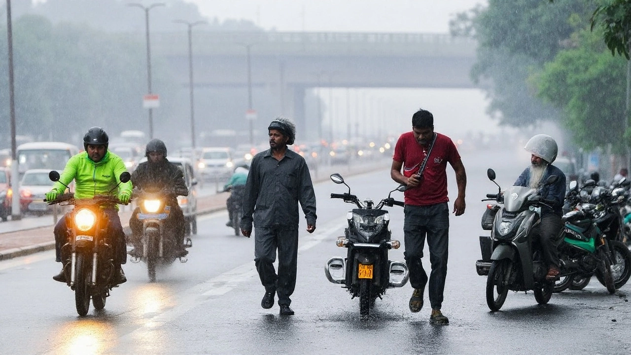
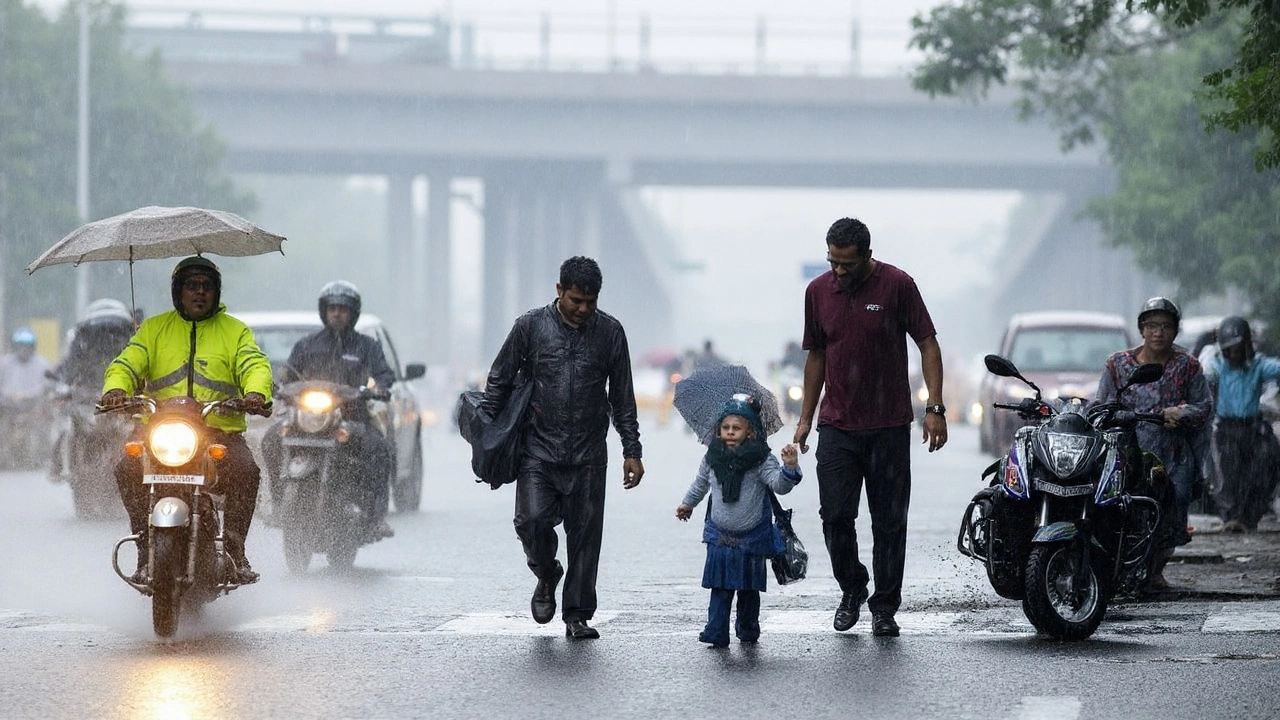
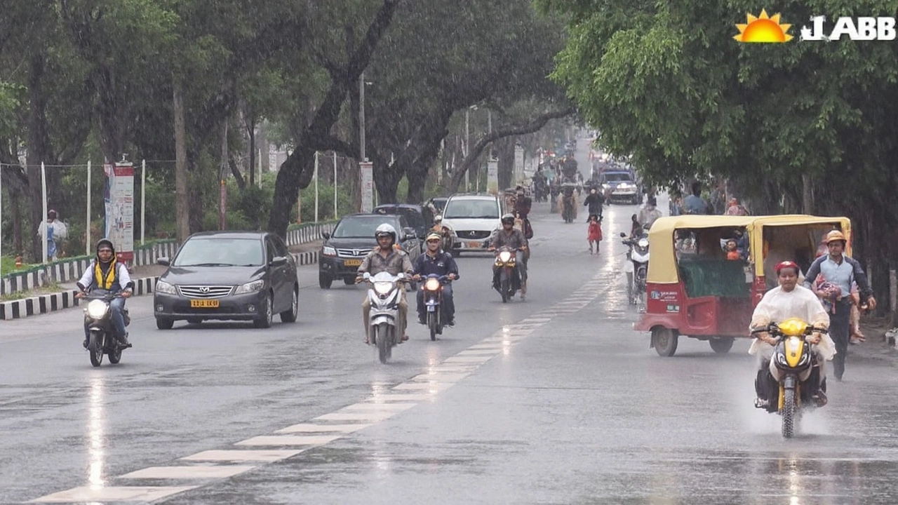
The India Meteorological Department (IMD) has issued a heavy‑rain warning for Delhi‑NCR until Sept 6. Expect thunderstorms, lower temperatures by 3‑5 °C, and a swollen Yamuna that may cross the danger level. Roads near Old Railway Bridge are closed, and cremations at Nigambodh Ghat are paused. If you’re heading out, keep an eye on traffic updates – the Noida‑Delhi commute can stretch beyond five hours when the river swells.
In the north, Himachal Pradesh and Uttarakhand are on red alert. Very heavy rain could trigger flash floods and landslides. The states have opened relief camps and are pumping water out of low‑lying areas. If you’re traveling to hill stations, pack sturdy shoes and be ready for sudden road closures.
Uttar Pradesh faces a monsoon onslaught across 51 districts, including Noida and Ghaziabad. IMD warns of thunderstorms, lightning, and possible waterlogging. Schools are closed in several districts, so families should have a backup plan for kids.
What to Expect This Week
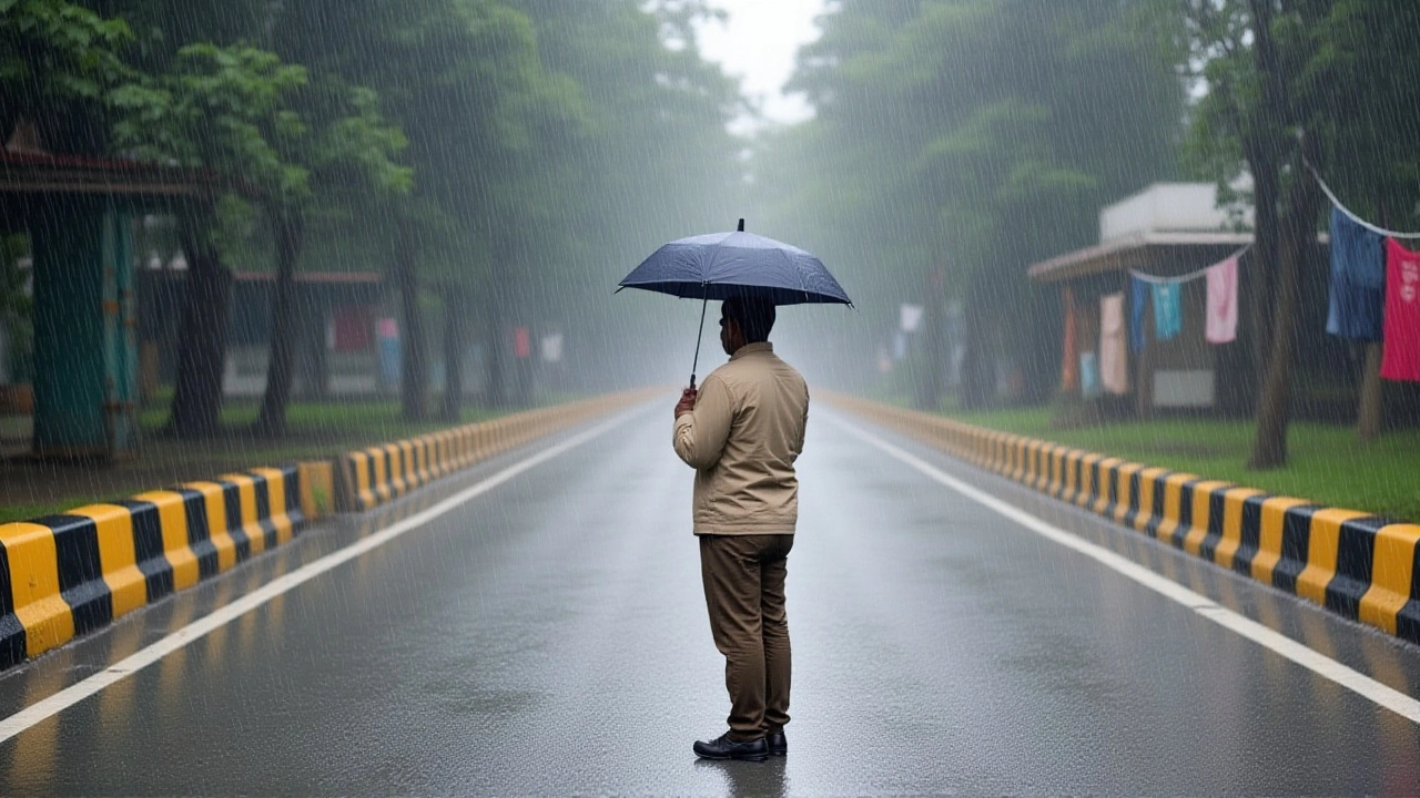
Delhi‑NCR will see intermittent showers that bring a quick break from the scorching heat. Temperatures will hover between 22 °C and 33 °C, with humidity staying high. Expect sudden downpours in the afternoon, so carrying a compact umbrella is a smart move.
West coast states like Goa and Konkan are bracing for torrential rain. The heavy downpours could disrupt travel plans, especially trains and flights. If you have a beach holiday, check local forecasts daily and be ready for possible delays.
In the east, Bihar’s weather will swing between heat and short rain spells. By mid‑September, daytime temps may hit 34 °C, but a 50 % chance of rain around Sept 20 could offer relief. Keep hydrated and wear light cotton clothing.
For those in the north‑east, Uttarakhand’s Nainital and Bageshwar will get the first monsoon showers after June 20. Expect a mix of rain and sunshine – perfect for a quick trek if you don’t mind a little drizzle.
Quick tips to stay safe:
- Check IMD alerts every morning – they update hourly during active warnings.
- Keep a waterproof bag for important documents and electronics.
- If you’re driving, avoid low‑lying routes when water levels rise.
- Store enough drinking water and non‑perishable food if floods are likely.
- Stay in touch with local authorities for evacuation orders.
Weather in India changes fast, but with the right info you can stay ahead of the storm. Bookmark this page for daily updates, and share it with friends who need to know what’s happening in their area.
Cyclone Montha Threatens Chhath Puja Celebrations Across Eastern India with Rain, Winds
Cyclone Montha threatens Chhath Puja 2025 celebrations across Bihar, Jharkhand, and Delhi as heavy rain, strong winds, and poor air quality collide with sacred rituals. The IMD warns of dangerous conditions during key prayer times.
IMD Issues Orange Rain Alert for Five Jharkhand Districts as Heavy Showers Loom
The Indian Meteorological Department issued an orange rain alert for Garhwa, Palamu, Latehar, Chatra and Hazaribagh as heavy showers threaten Jharkhand on Oct 5‑6, 2025.
Delhi Rain Alert: IMD warns of heavy showers till Sept 6 as Yamuna swells and cities across North India go on high alert
IMD has warned of heavy to moderate rain in Delhi-NCR through Sept 6, with thunderstorms and below-normal day temperatures. The Yamuna has crossed the danger mark, forcing closures at Old Railway Bridge and disrupting cremations at Nigambodh Ghat. Himachal and Uttarakhand face extremely heavy rain risk; Punjab has shut all educational institutions until Sept 7. Flights are disrupted as airlines caution travelers.
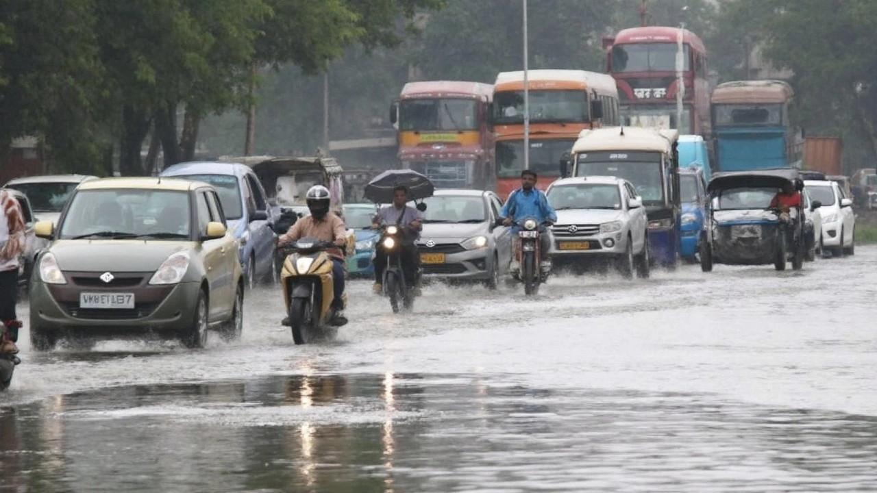
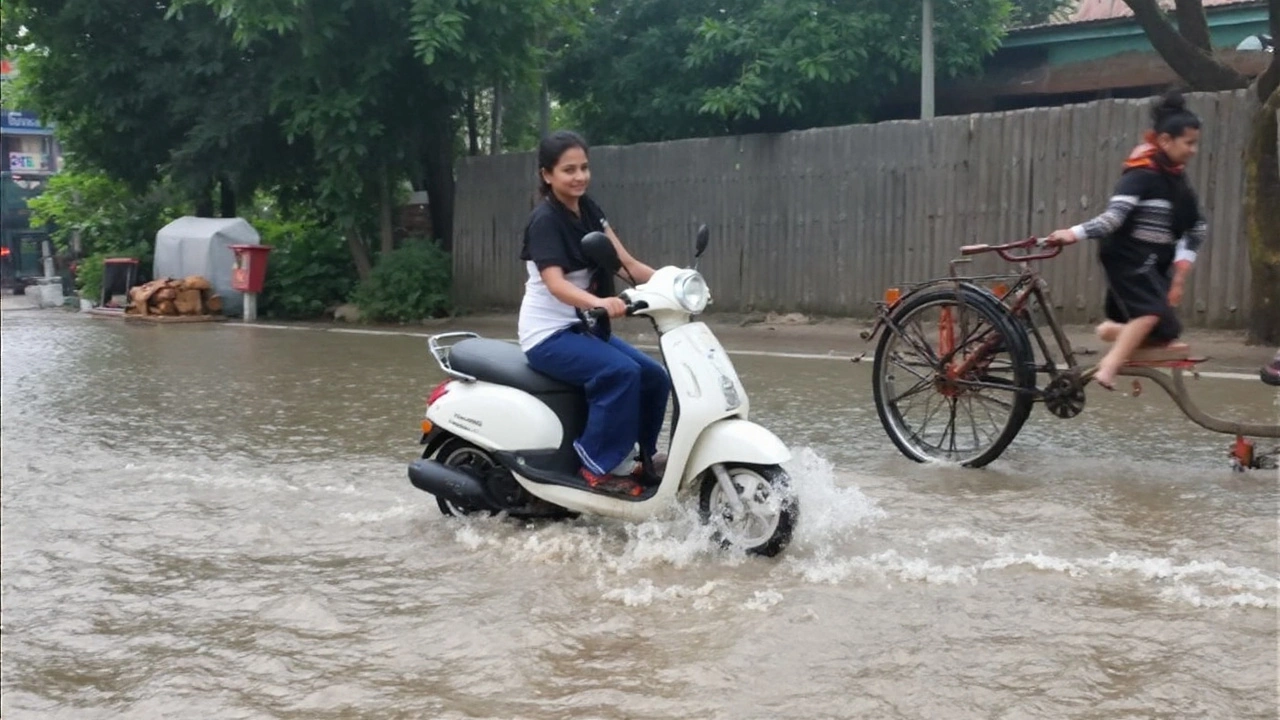
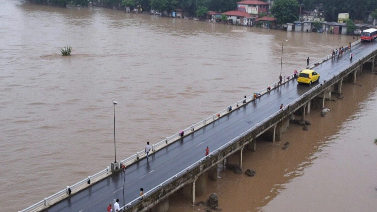
Delhi-NCR floods snarl Noida–Delhi commute for 5+ hours as Yamuna crosses danger mark
Hours-long jams, submerged roads, and mass evacuations hit Delhi-NCR as the Yamuna swells to 207.43 m, its third-highest mark since 1963. Noida–Delhi trips stretched beyond five hours. Parts of Janakpuri and NH-44 caved in, schools shut, and cremations at Nigambodh Ghat were halted. Over 12,000 people are displaced, with 38 relief sites opened as authorities race to pump out water and plan diversions.
Delhi-NCR Weather Alert: Rain, Thunderstorms Forecast Till Sept 6; Himachal, Uttarakhand on Red Alert
IMD has extended rain and thunderstorm alerts for Delhi-NCR till September 6. Parts of Himachal Pradesh and Uttarakhand are on red alert for very heavy rain and flash floods. Gurugram advised work-from-home after 100 mm rain in four hours, and some schools shifted online. Temperatures are 3–5°C below normal, and flood watch continues as the Yamuna level at ORB may cross danger mark.
Independence Day 2025 Weather: Cool Showers in Delhi-NCR, Heavy Rain Likely in UP and Uttarakhand
India’s 79th Independence Day will be a wet, cooler affair for many regions. Delhi-NCR will see cloudy skies with light to moderate rain, temperatures around 22–33°C, and a high chance of showers during morning and evening. IMD expects heavy rain in parts of Uttar Pradesh and Uttarakhand, raising risks of waterlogging and landslides. Celebrations at Red Fort should proceed under overcast skies.
Bihar Weather Forecast: Heat and Heavy Rain to Shape September 2025
Bihar heads into September 2025 with days around 27–34°C, muggy nights, and 8–15 rainy days. Patna mirrors the state trend. The hottest average is expected around Sept 1, while the coolest readings fall near Sept 30. Gaya could touch 97°F at midday; Aurangabad carries a 50% rain chance around Sept 20 with light southwesterly winds. Hydration and rain gear will matter.
Uttar Pradesh Faces Heavy Rain Onslaught: IMD Red Alerts Trigger Flood Fears, Widespread School Closures
Heavy monsoon rains have hammered over 40 districts in Uttar Pradesh, with red alerts from IMD causing floods, school closures, and widespread disruption. Emergency forces are rescuing people in cities like Kanpur, Lucknow, and Ayodhya as water levels rise and rainfall continues. The region braces for more downpours in the coming days.
Delhi-NCR Sees Record-Breaking Clean Air in July 2025 as Monsoon Rains Wash Away Pollution
Delhi-NCR enjoyed its cleanest July in over 11 years, with AQI regularly below 50 thanks to heavy rains. The city logged 118 clean air days in 2025, beating previous records, but the downpour also brought major waterlogging and traffic chaos. Cloud-seeding is planned for the months ahead to keep pollution down.
Heavy Rainfall Triggers Deadly Landslides and Floods in Himachal, Uttarakhand, and Maharashtra
India faces severe weather chaos as heavy rainfall warnings spread across multiple states. Himachal reports 78 deaths, with major damage in Mandi. Uttarakhand braces for landslides, while Maharashtra is on red alert for extreme rainfall. Gujarat, Odisha, and Delhi also face disruptions.